
Stormwind Simulator victorious in 'Apps4Finland'
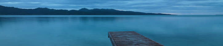
In Southern Finland, boats are the main means of transport between the many small islands in the Archipelago. Navigating the area is an extremely complex task, which can be dangerous and challenging due to high traffic density and inclement weather conditions. When planning a boat trip, visitors are advised to pay attention to ship traffic, such as large transport and container ships. Regular ferry routes also have to be taken into consideration.
The world's first boat simulator with authentic Archipelago navigation, all developed in Dyalog APL, took the victory at the Fifth annual Apps4Finland contest. The Apps4Finland competition seeks creative and inspiring ways of utilizing open data. Entries are evaluated according to potential impact on target users, and the ability to both inspire and enable others to use data and to decipher complex dependencies in terms of data visualisations. The contestants were invited to solve domain specific challenges related to tourism, communication between citizens and decision makers, public transport as well as the utilization of personal transaction and health information.
Winning the Apps4Finland award is no small feat given that Finland is the country that also gave the world the game of 'Angry Birds'. We hasten to give Tomas Gustafsson, the Dyalog APL developer behind Stormwind, our warmest congratulations.
On the last day of Dyalog '13 in Florida, the delegates were literally blown out of the water, when Tomas presented Stormwind. We were sat in a room, but all felt that we were on-board a boat, navigating in all weather conditions, in the Finish Archipelago. It was (almost) a 3D experience, but without having to wear the glasses.
We thought it would be interesting to get a bit more information about Stormwind, and for those of our readers who didn't manage to attend the presentation last October we will provide a couple of links in the bottom of the page.
Tomas explains, "The reason the simulator is so realistic is because we're using real data which have been provided from Lantmδteriverket (The National Land Survey), Skogsforskningsinstitutet (Finnish Forest Research Institute) and more. This gives us the ability to create a virtual reality environment. Currently the Simulator covers more than 30,000 square kilometres of 'navigation charts' / 'area with content'. The simulator fetches, and shows, thousands of navigational objects, buildings, lighthouses, trees and more - it simply attempts to show the environment as realistic as possible. It is the first boat simulator in the world to re-create an authentic environment. All the objects are placed on digital maps using Electronic Nautical Chart (ENC) data – the same data that form the basis for the well-known and daily used, paper based sea navigation charts, and the charts found in chart plotters on boats and ships.
"The simulator works with other vessels – so you are no longer able to pretend that you and your boat are the only ones navigating the area. You can choose how many other vessels you want to 'play with', and how you want them to behave. They will move in the simulator using artificial intelligence.
"Time and space are re-created as you would experience them in the real world. Beaches, height of the landscape, light signals and lighthouses, the seabed below water etc. What the simulator does is create a unique geospatial solution which very precisely handles the spheres of Mother Earth.
"The waves are calculated in real-time using a very complex wave model, which has been developed to mimic the waves in the Gulf of Finland and the Baltic Sea. The height of the waves depends on the wind direction and the force of the wind, as well as the distance to the nearest landfalls. It is possible to encounter waves several metres high, and you will be able to experience breaking waves with white horses. If it rains, the raindrops will create traces on the surface of the sea. Light, clouds and objects will further create traces and patterns on the surface of the water.
"The Radar Simulation is created using real echoes – or more precisely, 3D shadowing algorithms. Objects within visual distance will create echoes, whilst objects which are not in view remain in radar dead zone. The reflecting objects create stronger echoes, depending on their characteristics as described in the digital mapping material. You are able to see the radar image simultaneously, whilst still looking at your surroundings. Navigating in the dark is always a challenge, and it is probably the finest example for using the simulator as it comes fully equipped with thousands of lights and with precise light sectors and characteristics.
"You can define the weather you would like to work with – based on approximately 10 key parameters – and you can pre-program them for up to 20 instances of future time, thus creating weather which deteriorates from smooth and sunny, to bad with/without rain, high winds etc.
"Finally the simulator can be connected to several external mapping programs; the simulator simply replaces the GPS, and is able to send identical NMEA messages. And navigation can take place using a boat steering wheel, a speed regulator or a joystick - all Windows gaming input devices are supported.
"Currently ongoing is the super-challenging task of supporting multiplayer, with peers sharing a common world. The simulator already forms clouds in the internet, and there is a dense ship trading and data ownership race ongoing between the participants. This is highly challenging, since everything happens asynchronously and nothing can really be taken for granted.
"I cannot over-emphasize the strength of Dyalog APL for all this", says Tomas. "Nothing stresses the computer system like a game or simulation, both in terms of data management and performance demand. With APL, we get both; we have the data on our fingertips, while we get an enormous code line throughput."
Watch the full 12 minute demonstration here.
To watch Tomas Gustafsson's presentation at Dyalog '13 (53 minutes) go here.